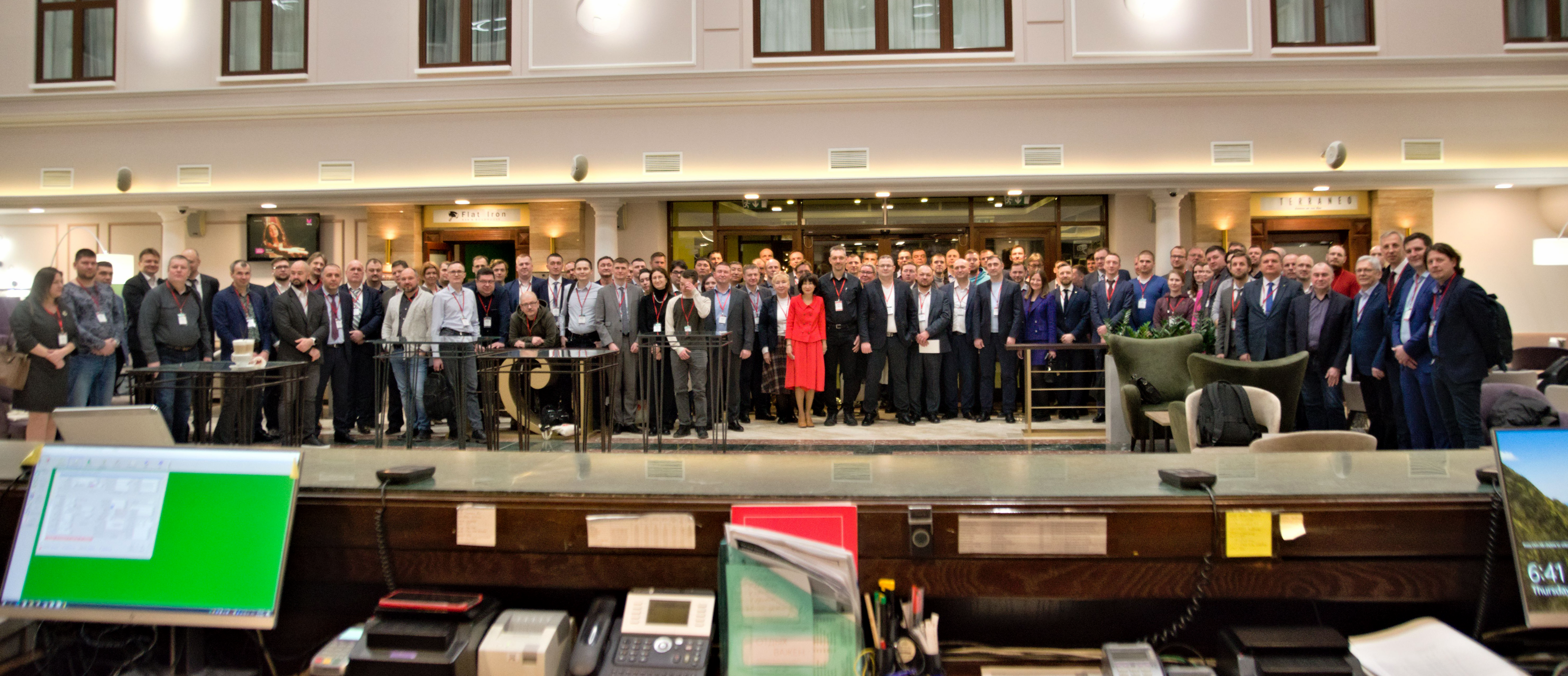
14th Conference ``Geodesy. Mine Survey. Aerial Survey. Navigation``


February 16, 2023
08:30 — 09:00 Grand opening of the conference
09:00 — 09:45 Plenary session
Grand opening of the conference
Plenary session
09:45 — 10:00 Martynova Elena, Federal Service of State Registration, Cadastre and Cartography, Deputy Head — National Spatial Data System
10:00 — 10:10 Kamynina Nadezhda, Moscow State University of Geodesy and Cartography (MIIGAiK), Rector, Doctor of Economics, Ph.D., Associate Professor — Welcome speech
10:10 — 10:15 Tararin Andrey, Moscow State University of Geodesy and Cartography (MIIGAiK), Ph.D., Associate Professor — Use of a unified electronic cartographic base layer for state and municipal needs – download presentation
10:15 — 10:30 Filatov Valeriy, Russian Space Systems, Doctor of Military Sciences, Professor, Advisor in Russian Academy of Rocket and Artillery Sciences, Chief Designer for Geodetic Technologies — Modern possibilities of information and navigation support for consumers in the Arctic zone of Russian Federation – download presentation
10:30 — 10:45 Spirenkov Vyacheslav, Federal Forestry Agency, Ph.D., Deputy Head — Collection and processing of spatial data in forestry, problems and prospects
10:45 — 11:00 Varushchenko Sergey, ESTI Group, Ph.D., Head of ESTI Group of Companies — The state of affairs with GIS in Russia. Local GIS “Axioma” is a reasonable choice of professionals – download presentation
11:00 — 11:15 Kobzeva Elena, Ural-Siberian Geoinformation Company – USGIK, Chief Engineer — On the question of the photogrammetric method – download presentation
11:15 — 11:30 Akovetskiy Viktor, National University of Oil and Gas «Gubkin University», Doctor of Technical Sciences, Professor of the Department of Geoecology — Geoecology and industrial safety: a view from space – download presentation
11:30 — 12:00 Coffee break
Moderator — Rebriy Aleksandr, Russian Space Systems, Ph.D.
12:00 — 12:15 Mingalyov Aaleksandr, State Institute of Applied Optics, Head of Software development sector — Remote Earth sounding compound based on scanning thermal imaging systems – download presentation
12:15 — 12:30 Zimin Mikhail, Scanex, Deputy head of the group — Satellite image of the Earth, view from Russia – download presentation
12:30 — 12:45 Balagurov Andrey, LoReTT, Development Director — Blockchain and remote sensing – download presentation
12:45 — 13:00 Fedorkova Yuliya, Russian Space Systems, Deputy head of the department — The possibility of using the orbital grouping of remote sensing spacecraft of the BRICS countries in the interests of state consumers of space information – download presentation
13:00 — 13:15 Shirshova Vera, Russian Space Systems, Leading Engineer — Promising Russian satellite radar monitoring systems – download presentation
13:15 — 14:00 Lunch
Section 1
Moderator — Vasin Kirill, R&PC Jena Instrument
14:00 — 14:15 Grimm Christian, IGI, CEO — IGI – Professional Aerial Cameras & Lidar Systems to Shape a New Era for Urban Mapping & 3D City Modelling – download presentation
14:15 — 14:30 Emel’yanov Ivan, R&PC Photonica, Head of Aerial Survey Direction — Aerial cameras in a new reality. Prospects for import supply and domestic development – download presentation
14:30 — 14:50 Shulyakovkiy Vsevolod, ArtGeo, Head of Laser Scanning Department — Quick receipt of a digital twin on the example of aerial lidar mapping with a UAV. Solutions of Green Valley International – download presentation
14:50 — 15:10 Vasin Kirill, R&PC Jena Instrument, head of Aerial Survey Department — The effectiveness of the use of large-format aerial survey systems – download presentation
15:10 — 15:25 V’yunov Mikhail, R&PC Jena Instrument, head of Data Processing Department — When you are a few and the dataset is huge. UltraMap 6.0 – download presentation
15:25 — 15:40 Smirnov Vadim, AeroGeodesy (Roscartography), Chief Engineer — Proposals for the development of documents in the field of standardization of requirements for lidar scanning, the use of which will ensure compliance with the requirements of Technical Regulations – download presentation
15:40 — 15:55 Drobiz Mikhail, Baltic Aerial Survey Enterprise (Roscartography), Ph.D., CEO — “Do you need digital topo-maps or enough money only for digital orthophoto?”: the specificities of geodetic engineering ordering in the Russian Federation regions – download presentation
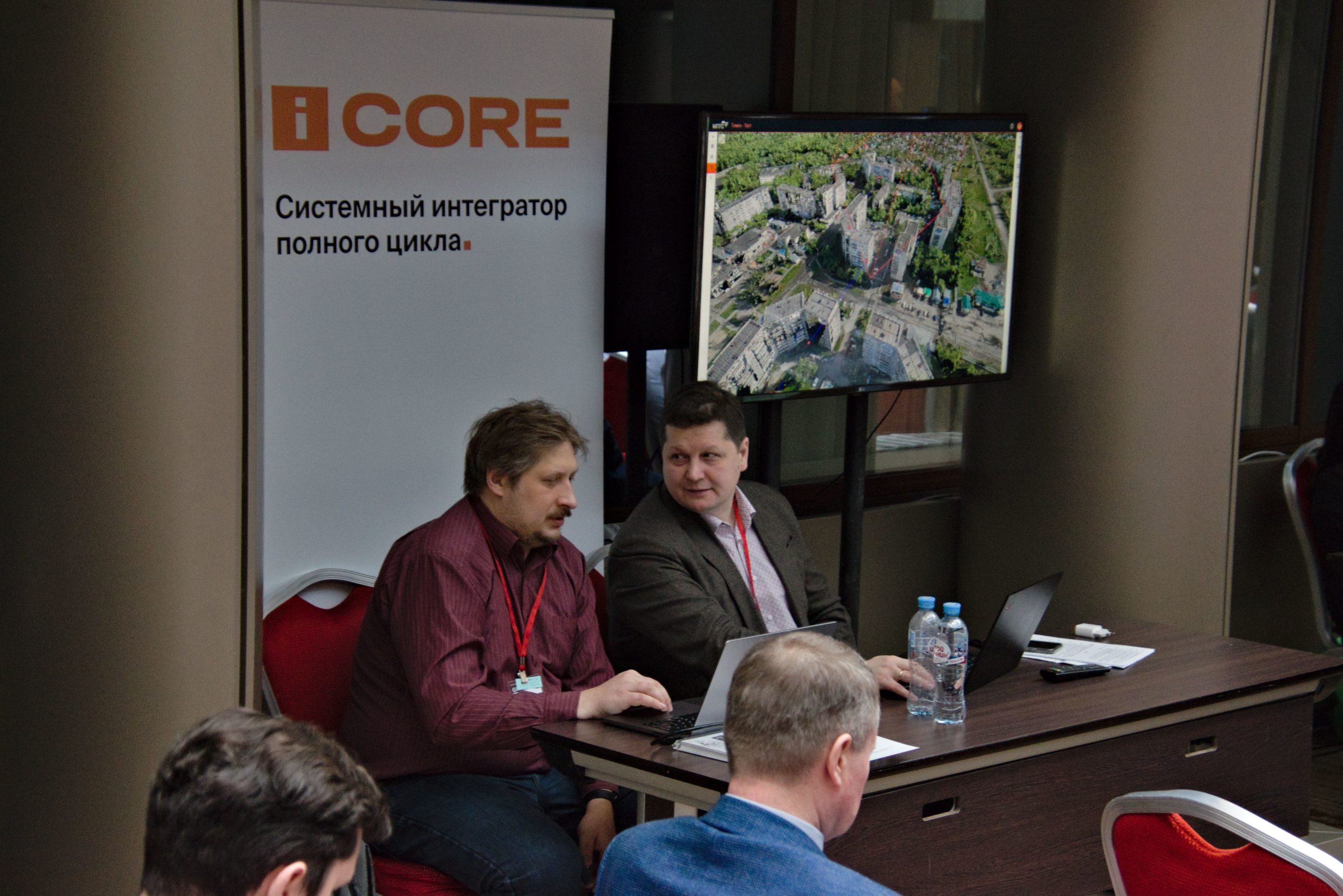
15:55 — 16:10 Dolgopolov Daniil, iCore, Ph.D., head of Project Management Department — Digital platform for monitoring the natural and technological environment – “MPTS”. Applied application for solving construction monitoring tasks – download presentation
16:10 — 16:25 Kopytov Andrey, Moscow City Trust of Geological, Geodetic and Cartographic Works, Deputy Head of the Mapping Department — Spatial data as the basis of the Digital Twin urban platform – download presentation
16:25 — 16:45 Coffee break
Section 2
Moderator — Tararin Andrey,Moscow State University of Geodesy and Cartography (MIIGAiK)
16:45 — 17:00 Korchagina Ol’ga, Racurs, Ph.D., Chief Engineer — Organization of photogrammetric workflow based on the PHOTOMOD digital platform – download presentation
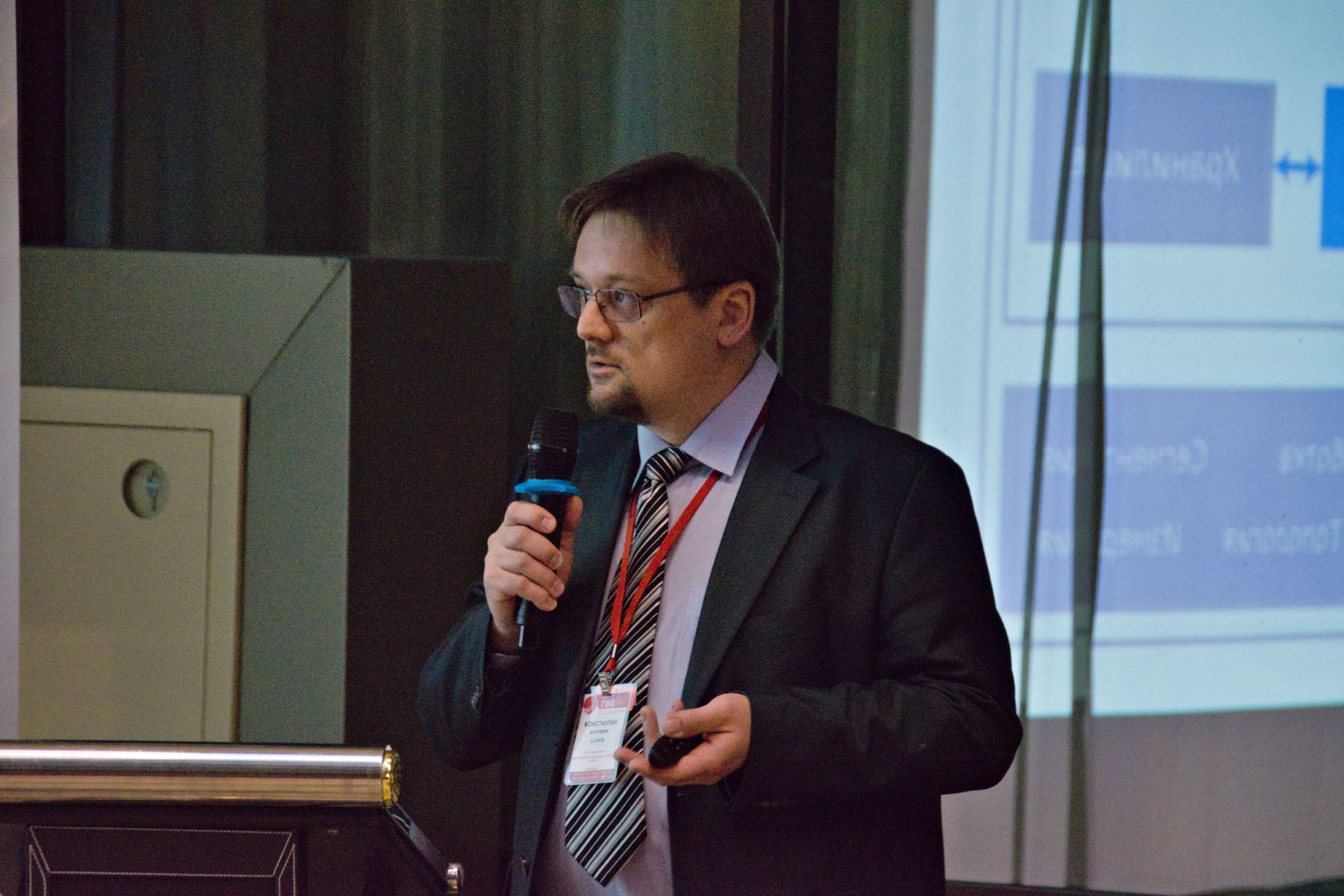
17:00 — 17:15 Sarayev Konstantin, Csoft Development, Deputy CEO for Scientific Work — ReClouds 3D scanning data processing software platform – download presentation
17:15 — 17:30 Baryshnikov Dmitriy, NextGIS, Technical Director — NextGIS platform capabilities for geodesy – download presentation
17:30 — 17:45 Stepanova Anna, SGP (SibGeoProject), Deputy Director of Software Development Department — Corporate GIS based on domestic software – download presentation
17:45 — 18:00 Aleksandrova Elena, UralGeoInform (Roscartography), Leading Technologist — Aspects of aerial photography processing by various digital cameras of large industrial enterprises. – download presentation
18:00 — 18:15 Riazanova Elena, Geoscan, Photogrammetry and Remote Sensing Specialist — Toolboxes for working with data in Agisoft Metashape software – download presentation
18:15 — 23:00 Gala dinner
February 17, 2023
09:30 — 10:00 Welcome coffee break
Section 3
Moderator — Karavanov Mikhail, independent expert
10:00 — 10:10 Zaliznyuk Aleksandr, Military Topographical Directorate of the Armed Forces of the Russian Federation, Head of the Military Topographic Directorate of the General Staff of the Armed Forces of the Russian Federation – Head of the Topographic Service of the Armed Forces of the Russian Federation, Major General — Welcome speech
10:10 — 10:25 Kravchuk Ivan, Moscow State University of Geodesy and Cartography (MIIGAiK), Ph.D., Associate Professor — The problem of carrier phase ambiguity resolution in GNSS measurements is a myth – download presentation
10:25 — 10:40 Raver Aleksey, EFT Group, Deputy CEO — Satellite geodetic equipment and special software using as a parts of geodesic network of special purpose. Challenges of the time. – download presentation
10:40 — 10:55 Karavanov Mikhail, independent expert — Is camera inside GNSS receiver an attempt to follow the fashion or future requirement? – download presentation
10:55 — 11:10 Zagretdinov Renat, Kazan` (Volga region) Federal University, Ph.D., Associate Professor — Global and regional movements of permanent GNSS reference stations – download presentation
11:10 — 11:25 Plyusnin Evgeniy, R&PC GPScom, Chief Engineer — The GNSS module form factor. Market impact – download presentation
11:25 — 11:40 Mazurkevich Andrey, All-Russian Research Institute of Physical, Technical and Radio Engineering Measurements, Head of the Department of metrological support of geodetic measurements — The state primary reference for the coordinates of the location GET 218-2022 – download presentation
11:40 — 12:00 Coffee break
Section 4
Moderator — Zagretdinov Renat, Kazan` (Volga region) Federal University
12:00 — 12:15 Kharitonov Denis, UGT-Holding, CEO — Problems of UAV use related to GNSS and ways to solve them
12:15 — 12:30 Obukhov Evgeniy, PRIN, Head of Mobile Lidar Mapping Department — Solutions for mobile laser scanning in surveying – download presentation
12:30 — 12:45 Brusilo Vladimir, AGM Systems, Deputy General Director — Mobile and aerial laser scanning technologies from the AGM Group. A dozen and one year in the engineering survey market – download presentation
12:45 — 13:00 Matveev Anton, PRIN, Head of Unmanned Hydrographic Vehicles Department — The use of the unmanned vessel Apache in surveys on water bodies – download presentation
13:00 — 13:30 Potapov Mikhail, SGP-ADK (Sibgeoproject), Chief Engineer — The optimal number of GCP for UAV aerial survey on mining enterprises – download presentation
13:30 — 14:15 Lunch
Section 5
Moderator — Kurkov Vladimir, Moscow State University of Geodesy and Cartography (MIIGAiK)
14:15 — 14:30 Kadnichanskiy Sergey, Geoscan, Ph.D., Deputy CEO for Aerial Survey — About the possibility of using focal-plane shutter aerial cameras for aerial mapping with UAV – download presentation
14:30 — 14:45 Vitsko Denis, Panorama Design Bureau, Project Manager — Panorama Photo is a new software for automatic processing of images from UAVs – download presentation
14:45 — 15:00 Shulyakovkiy Vsevolod, ArtGeo, Head of Laser Scanning Department — Quick receipt of a digital twin on the example of aerial lidar mapping with a UAV. Solutions of Green Valley International. – download presentation
15:00 — 15:15 Oleynichenkо Roman, Skymec, Engineer Surveyor — The practice of using DJI unmanned aerial vehicles (UAV) for thermal imaging monitoring of various facilities and infrastructure components – download presentation
15:15 — 15:30 Striganov Roman, Uralpin, Chief Engineer — Experience of performing aerial lidar survey from UAV. Combining with other data when performing topographic survey – download presentation
15:30 — 15:45 Voronov Gennadiy, Gazprom Geotechnologies, Ph.D., Chief Mine Surveyor — Innovative methods of monitoring the development of landslide processes of the Abovyan underground gas storage station – download presentation
15:45 — 16:05 Coffee break
Section 6
Moderator — Mazurkevich Andrey, All-Russian Research Institute of Physical, Technical and Radio Engineering Measurements
16:05 — 16:20 Brovko Elena, Roscartography, Ph.D., Head of the direction of the Center for Scientific and Technological Development in Roscartography — National standardization: topographic monitoring when updating digital (electronic) topographic maps – download presentation
16:20 — 16:40 Lakeev Ivan, PRIN, Engineer Surveyor — New surveying standards: LandStar 8 and PrinCe i80 Pro – download presentation
16:40 — 17:00 Lesnichenko Vadim, All-Russian Research Institute of Physical, Technical and Radio Engineering Measurements, Junior Researcher — Development of a promising complex of metrological support for laser coordinate-measuring systems – download presentation
17:00 — 17:25 Shvidkiy Valentin, Moscow State University of Geodesy and Cartography (MIIGAiK), Ph.D., Associate Professor — Peculiarities of geodetic support for the construction of railway and road bridge crossings over the Kerch Strait (Crimean bridges) – download presentation
17:25 — 17:45 Kurkov Vladimir, Moscow State University of Geodesy and Cartography (MIIGAiK), Ph.D., Associate Professor — Engineering geodetic education in Russia
17:45 — 23:00 Summing up and final dinner
Section 7
Bashirova Dinara, St. Petersburg State University of Railway Transport, PhD student, St. Petersburg — “Experimental studies on the application of an integrated approach to geodetic monitoring of road foundation settlements on soils with low bearing capacity” (in absentia) — download thesis — download presentation
Sharafutdinova Anzhelika, St. Petersburg State University of Railway Transport, PhD student, St. Petersburg — “Calculation of ground-based laser scanning parameters when surveying industrial facilities” (in absentia) — download thesis
Master classes on February 17, 2023
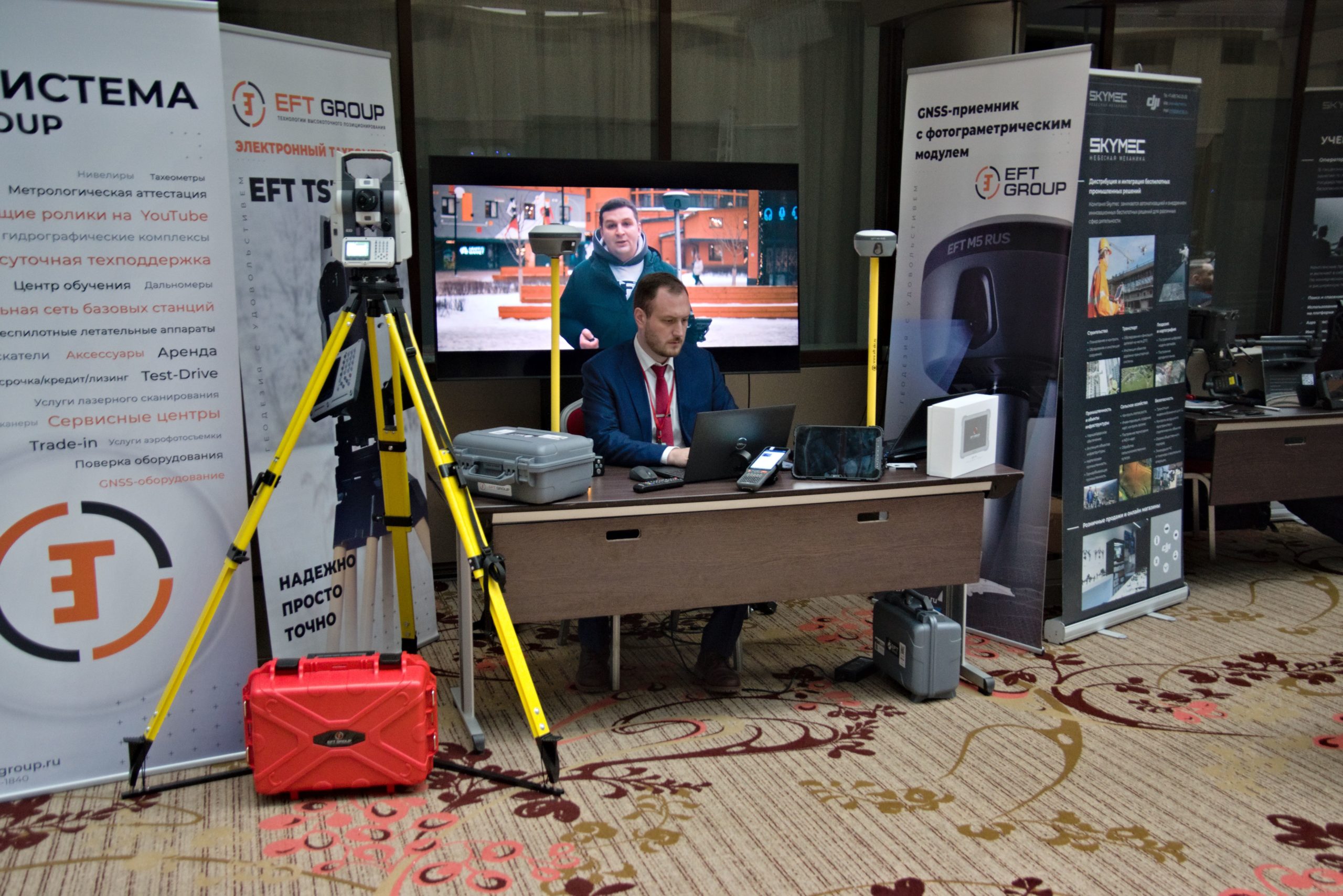
12:00 — 13:30 Yashin Il’ya, EFT Group, Technical expert — GNSS receiver with photogrammetric module
14:15 — 15:00 Vagin Pavel, Geoscan, Leading GIS specialist — Toolboxes for working with data in the Agisoft Metashape software
15:45 — 17:15 Borzov Andrey, Panorama Design Bureau, Leading developer — Panorama Photo is a new software for automatic processing of images from UAVs